| Previous Leg | Leg 16: Walvis Bay to Libreville | Next Leg |
| Date | From | To |
|---|---|---|
| Thu 08/05 | FYWB - Walvis Bay, Namibia / UTC +01:00 | FOOL - Libreville, Gabon / UTC +01:00 |
| Departure | Enroute | Arrival | Distance | Avg. Spd. | Max. Spd. | Max. Alt. | Fuel | |
|---|---|---|---|---|---|---|---|---|
| (NM) | (KT) | (KT) | (FT) | (USG) | ||||
| Estimated | 07:00 (06:00Z) | 09:33 | 16:33 (15:33Z) | 1,433 | 153 | |||
| Actual | 09:25 (08:25Z) | 10:33 | 19:58 (18:58Z) | 1,515 | 144 | 178 | 12,288 |
Again this is a very dry area with little if any rain or weather expected over the entire route.
| Temperature in Libreville | Low: 62°F, High: 82°F |
| July Precipitation | 0.1 Inch |
| Winds Aloft at 7,000 to 10,000 Feet | From the east at 7 MPH |
A 7:30 AM pickup by Astrid and Rotary member "Onkle Prix" and off to the airport. Fueling and Immigration was slow and finally off to Libreville.
We had to climb to 11,000 feet to fly over the rising desert terrain, a vast area of unpopulated and unproductive land. Things got a little better over Angola and quite nice over Gabon.
It was dark when we arrived and because of prohibited areas we felt more secure to follow the arrival procedures, which required an 11 DME arc approach to the localizer. It was a complex arrival and required a few minutes to figure out. Once done Ed flew the ILS masterfully.
Our selection of the Novotel Libreville proved to be a bummer. Shoddy, unclean and poor food. Fortunately it was a one nighter.
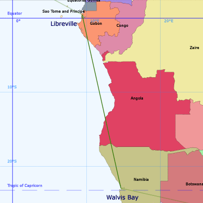
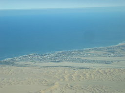 Photo Courtesy of Ed or Dick
Shortly after takeoff from Walvis Bay, we approach Swakopmund
|
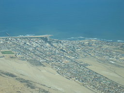 Photo Courtesy of Ed or Dick
Swakopmund
|
 Photo Courtesy of Ed or Dick
Without our autopilot fully functional, we wandered off our assigned altitude, and ran into the big boys over the coast of Angola
|
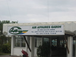 Photo Courtesy of Ed or Dick
Our Skyplan contact in Libreville
|
| Previous Leg | Leg 16: Walvis Bay to Libreville | Next Leg |